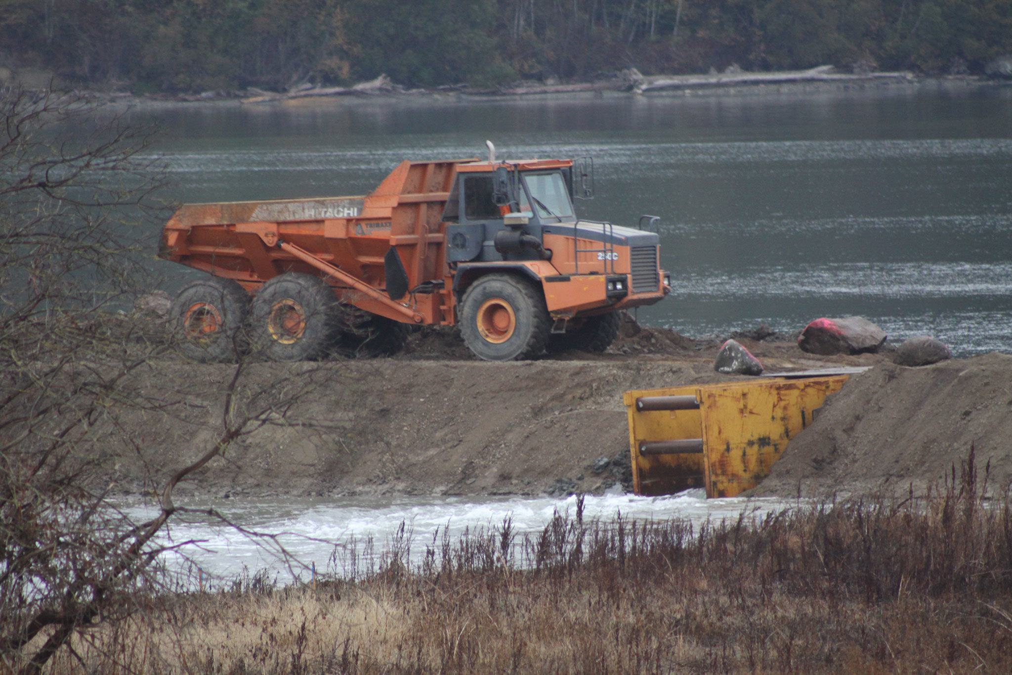
A breach in the old dike near Dike Road let saltwater from Dugualla Bay pass through a small opening in the earth at high tide. The trouble is, those conditions didn’t occur until after dark.
Amy McInerney, outreach manager with the Whidbey Camano Land Trust, and Bobby Edwards, an environmental specialist with the Washington Department of Transportation, weren’t going to miss it the second time.
On a foggy Thursday morning, the two marveled at the changing landscape before them. A trickle had become a small current.
“Look at that water moving,” McInerney said.
“It’s starting to flow,” Edwards added.
A project to breach the century-old dike and build a new, improved, more elevated one underneath Dike Road is wrapping up after five months of moving earth and diverting local traffic.
The DOT project served dual purposes, protecting homes and farmland west of Dike Road and restoring a saltwater marsh on a portion of land acquired by the land trust in 2007 to benefit juvenile salmon and other marine life.
Dugualla Bay had supported a saltwater marsh until 1918 when local residents constructed a dike near the beach to create farmland, according to the state.
Much of the area between the old dike and Dike Road had become a shallow freshwater wetland.
That is now changing and will continue over the years.
“This thing will transform dramatically over time,” Edwards said. “As the intertidal actions happen, this thing will really start to change. In a year, it won’t even resemble anything like we’re seeing. It will start to resemble a saltwater estuarine habitat. That’s the hope.”
The land trust is calling the 23-acre portion of its 79-acre Dugualla Bay Preserve property that will be transformed to a marine marsh an important “pocket estuary.”
Ryan Elting, conservation director for the land trust, said earlier this year that the site has been recognized by numerous state agencies as one of the “top salmon restoration priorities” in the state.
The $4.5 million project became possible when the state needed a site for environmental mitigation to compensate for 3.5 acres of wetland loss during its Davis Slough Bridge project between Stanwood and Camano Island.
“This is a really big milestone for the land trust in terms of a significant, very tangible restoration project on the island,” McInerney said.
“Like one of my colleagues on the land trust board said yesterday, the Elwha Dam gets a lot of media attention and praise because they removed those dams to restore the habitat. On a local level, this is just as significant, removing essentially a dam barrier to restore this to a natural state for habitat.”
The area already is a resting spot for waterfowl and feeding grounds for herons and bald eagles. All three were hanging nearby Thursday despite the ongoing construction.
“One of the things that will be really beneficial is when pink (salmon) fry come out of the Skagit (River),” Edwards said. “They use this bay exclusively and they hang in here. They’re here a real short period of time before they go outbound. They’ll be one of the direct species that will benefit from this new construction.”
The work is scheduled to continue through the middle of the month then will resume in November with native plantings.
A section of the dam was cut out and a 40-foot wide metal box was put in place to allow tidal water to enter the wetland and construction trucks to still drive over. Work has started to remove the box and allow the water to flow in naturally.
Another small breach was made in the dike that can only be reached under extreme tidal conditions.
“The dike will go at some point,” Edwards said of the old dike. “Mother Nature will get all of this at some point. Five years? Fifty years? Fifty-five years?”
It will be cut away as part of a slow erosion process propelled by natural forces.
“This will change elevation over time,” Edwards said. “Not just from whatever is moved here. The Skagit pushes metric tons of material every year. It’s like a dump truck every five seconds all day long.”


