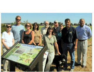
Thursday afternoon, Aug. 14, saw the dedication of the western section of Oak Harbor’s waterfront trail known as the Freund Marsh Trail.
This ceremony included the unveiling of three interpretive signs and six memorial park benches that have been installed throughout the length of the Freund Marsh Trail.
The development and completion of the Freund Marsh Trail was the result of the cooperative efforts of the Freund family, Conservation Futures Program and city of Oak Harbor. The restored wetland area includes a pond, native plants that replaced invasive non-native plants, and some snags to attract wildlife, all of which may be enjoyed from the trail.
The new, more-durable interpretive signs depict the plant, bird, and animal life that was and is present within the Freund Marsh. They replace the weather-worn signs designed by a group of students years ago. The interpretive signs are patterned after the Saratoga Passage Stewardship signs placed throughout the Whidbey and Camano Island waterfronts, which were designed by the Marine Resource Committee of Island County.
Maribeth Crandell, environmental educator for the city, showed one of the signs to Hank Nydam, parks director, and Rob Voigt, city planner. The three of them worked with Kris Wiltse, the sign illustrator; Dan Pedersen, the writer; and the Marine Resource Committee to create the signs that are appropriate for the Freund Marsh Trail. One of the signs even includes some historic photograph offered by the Freund family.
The speakers at the dedication ceremony included Mayor Jim Slowik, who acknowledged and thanked the Freund family for their contributions and spoke of the value of having the trail and open spaces within the city.
Nydam provided some insight into the timeline of the restoration work that was done, the bench contributors and the bridge contributor; Pedersen offered a few words; and Crandell spoke about the value of wetlands and open space in downtown and discussed the Freund Marsh bird and plant list brochures that are available. The entourage walked the length of the trail, stopping by each of the benches, interpretive signs, and the bridge along the route.
Eventually, if plans are fulfilled, the waterfront trail system will run from Scenic Heights to Maylor Point.


